Caribbean maps
Caribbean region | Country pages | Island maps | Small maps | PDF maps
This page has a list of Caribbean maps from Perry-Castañeda Library in the University of Texas. Reason for maintaining this page is that at the library map collection the Caribbean maps are in the same list with the rest of the Americas. It is easier to find the maps from a list that only includes the Caribbean maps.
The maps linked from this page are in public domain. Most of them are linked directly to University of Texas website (following their linking policy).
Caribbean region
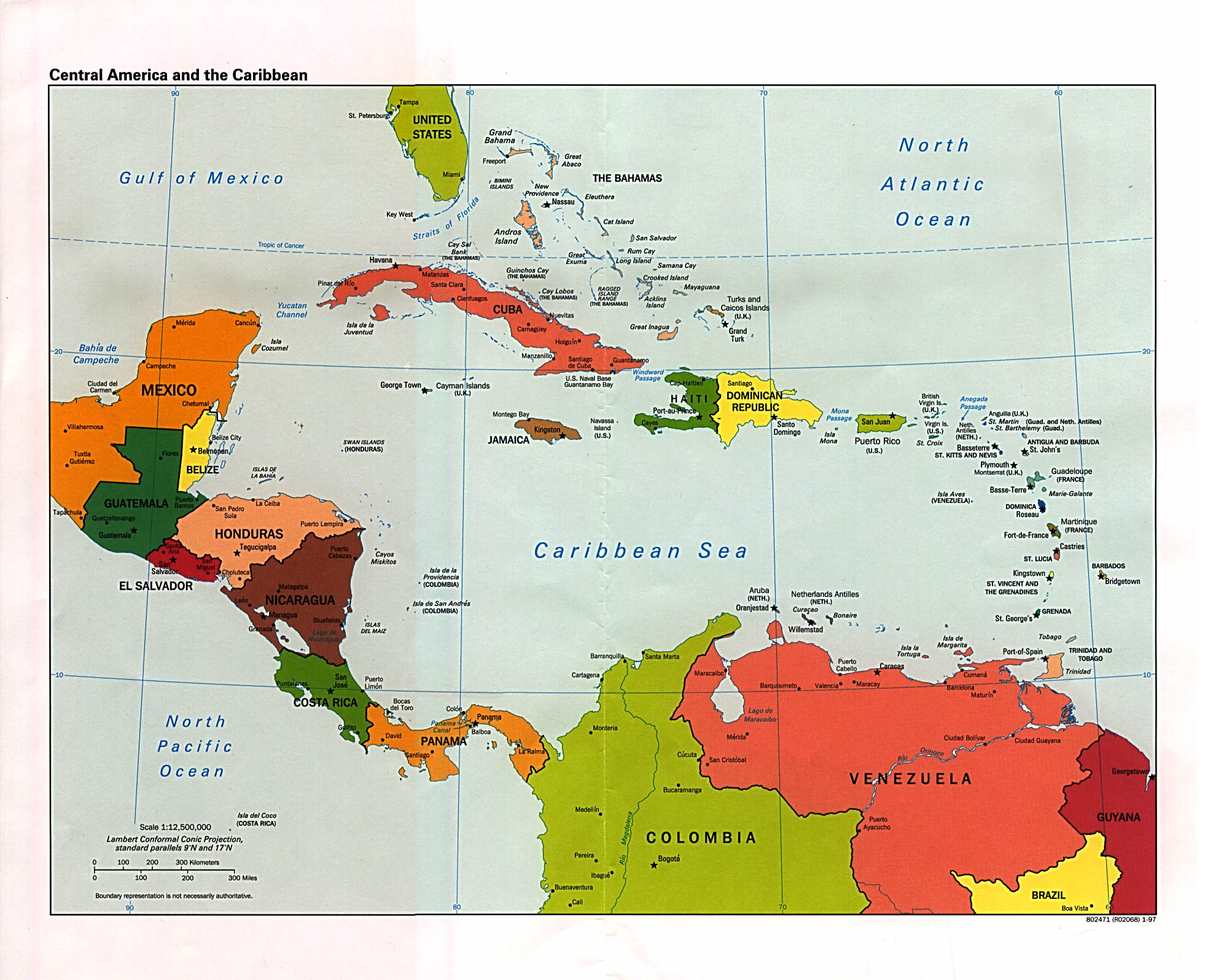
- Central America and the Caribbean - 1997 political
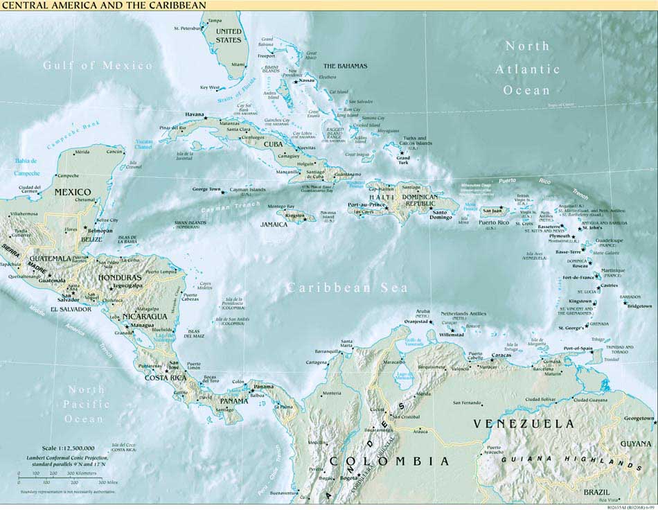
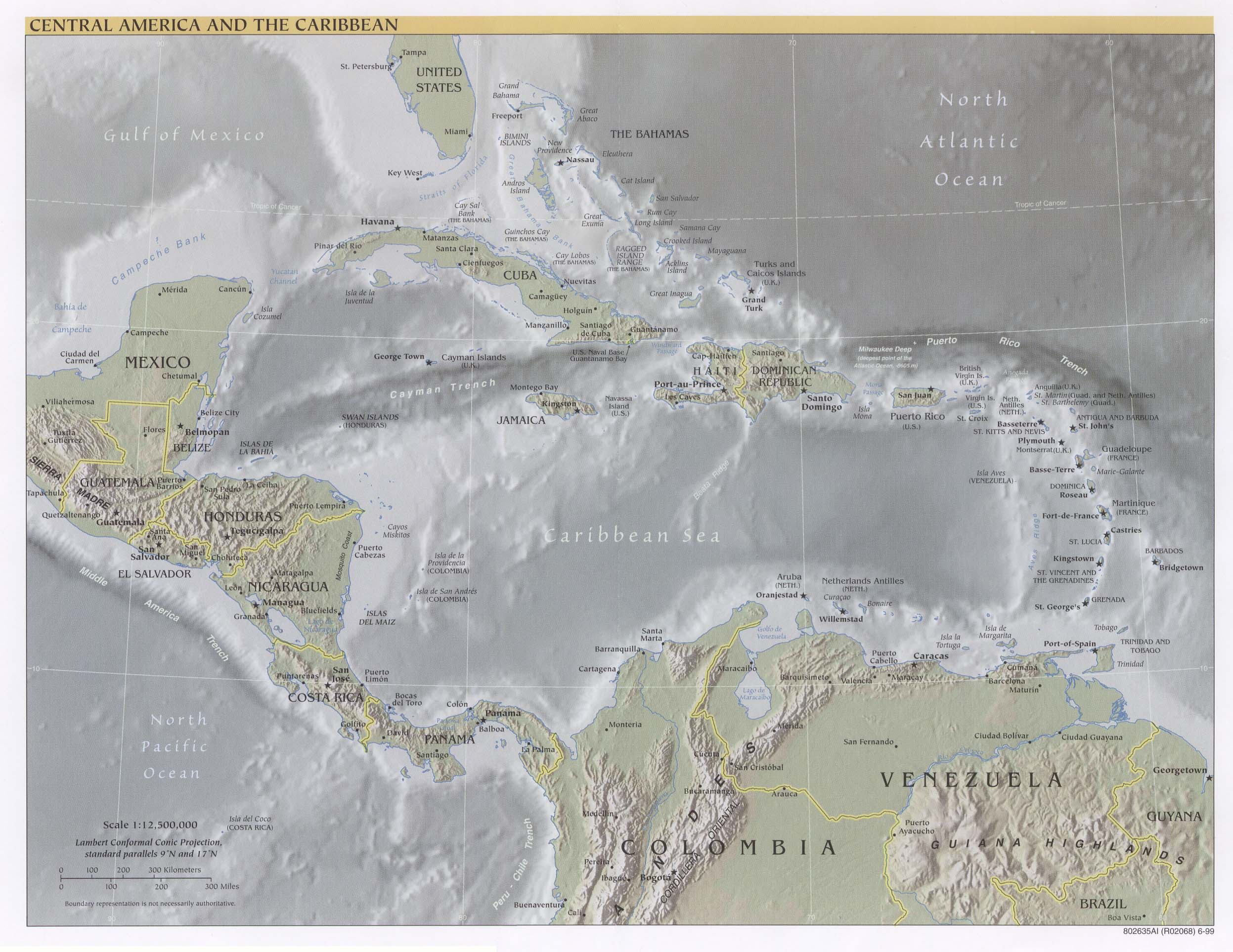
- Central America and the Caribbean - 1999 reference
- Central America and the Caribbean - 1999 reference [LARGE]
Country pages
Island maps
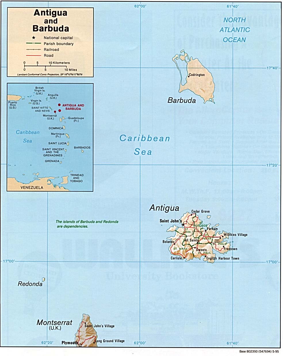
- Antigua and Barbuda - 1995 shaded relief
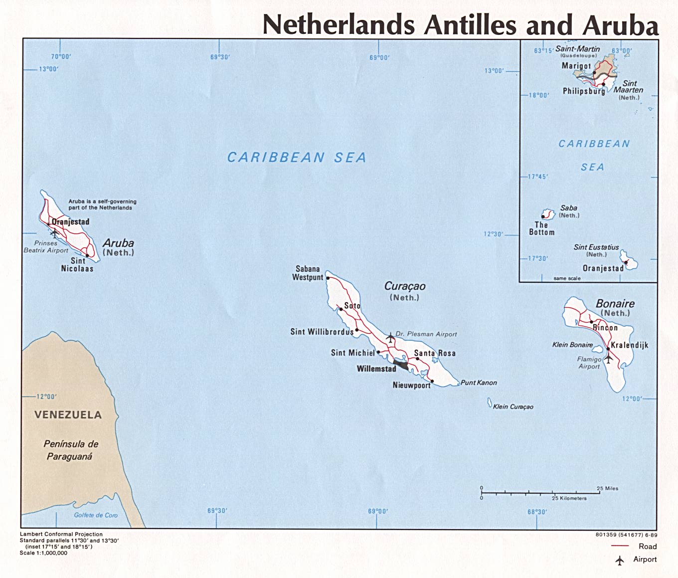
- Aruba - 1989 political
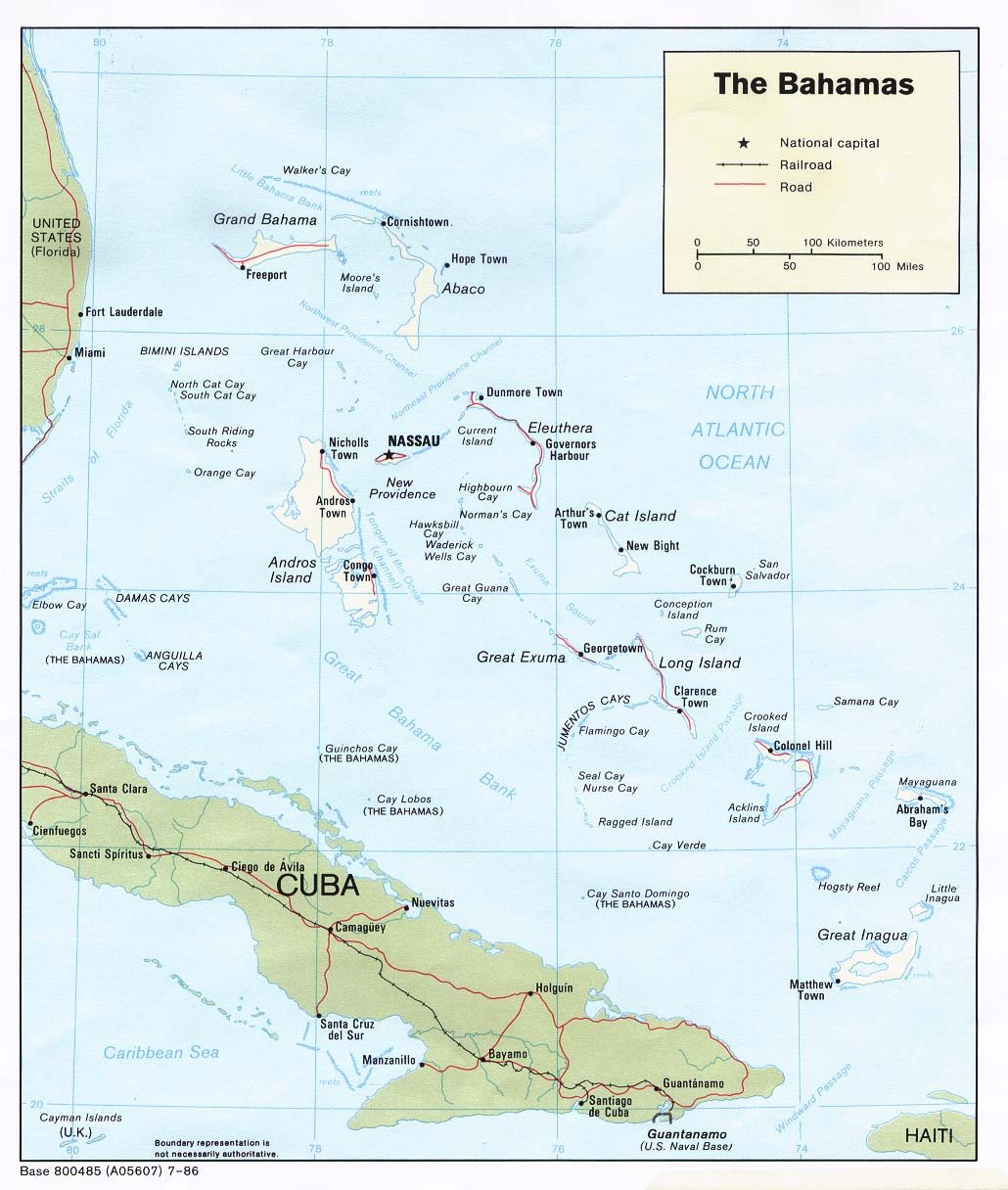
- Bahamas - 1986 political
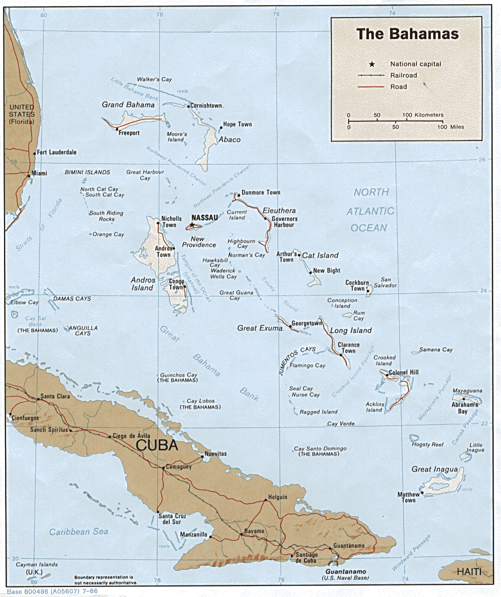
- Bahamas - 1986 shaded relief
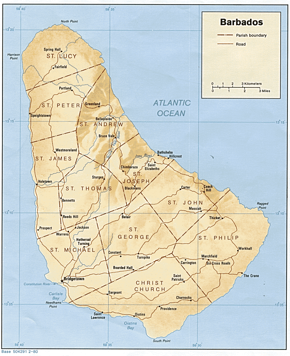
- Barbados - 1980 shaded relief
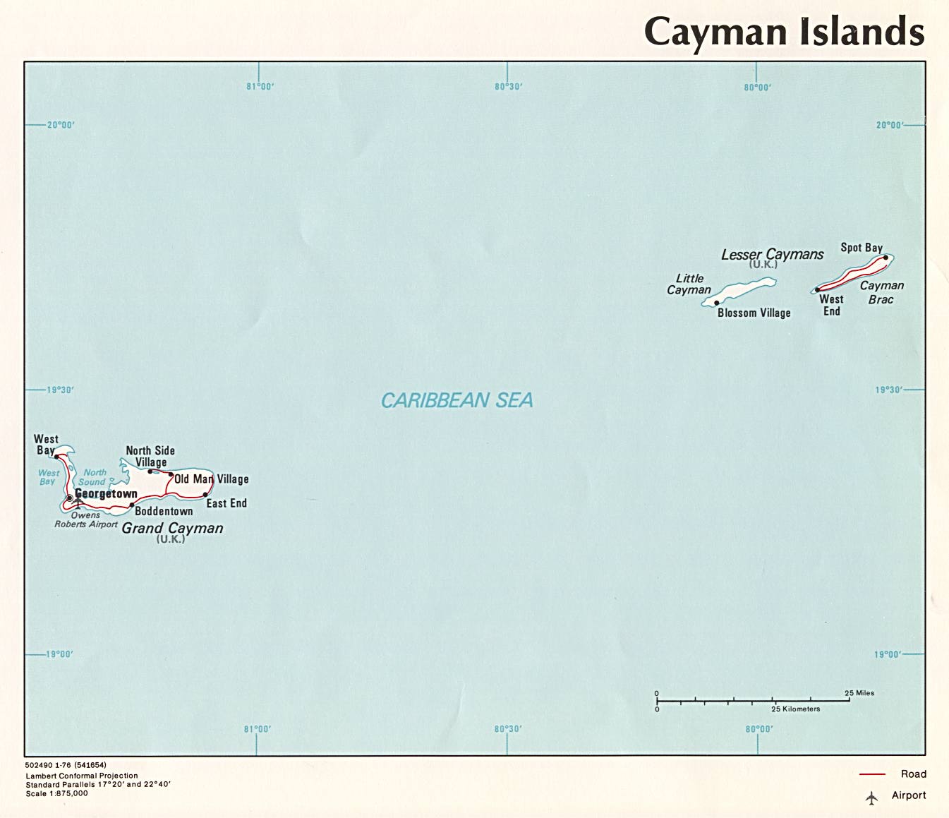
- Cayman Islands - 1976 political
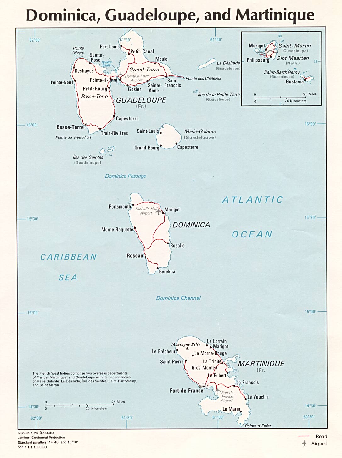
- Dominica, Guadeloupe & Martinique - 1976 political
- Dominica - shaded relief
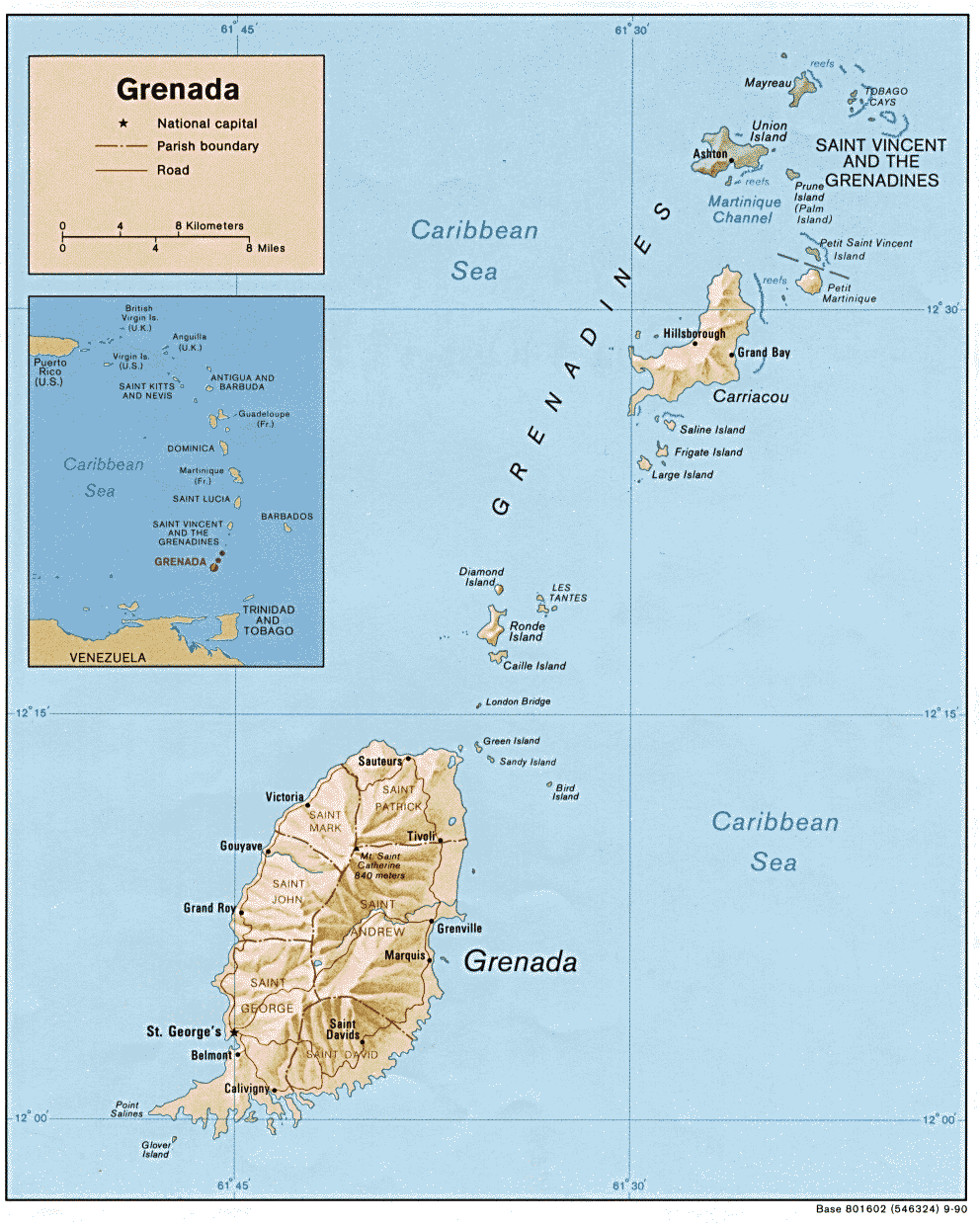
- Grenada - 1990 shaded relief
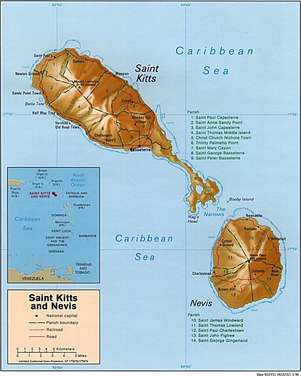
- Saint Kitts and Nevis - 1996 shaded relief
- Saint Lucia - 1991 shaded relief
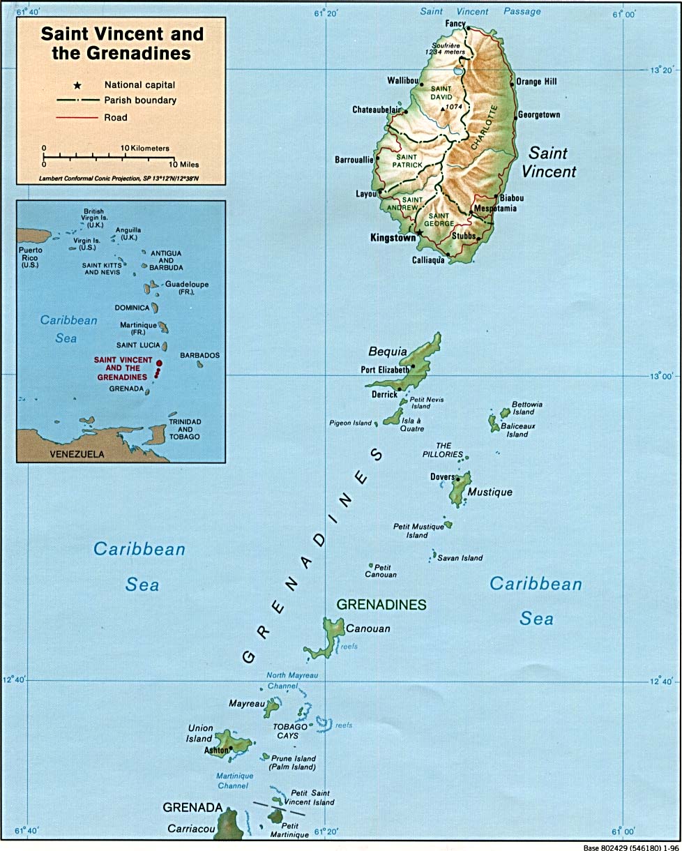
- Saint Vincent and the Grenadines - 1996 shaded relief
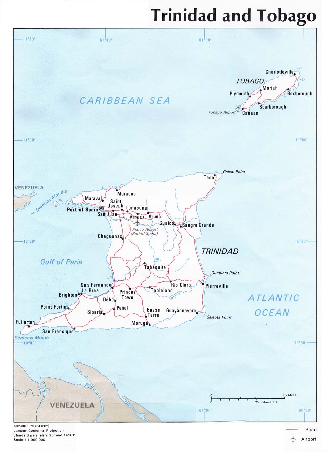
- Trinidad and Tobago - 1976 political
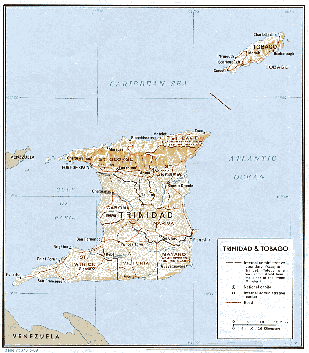
- Trinidad and Tobago - 1969 shaded relief
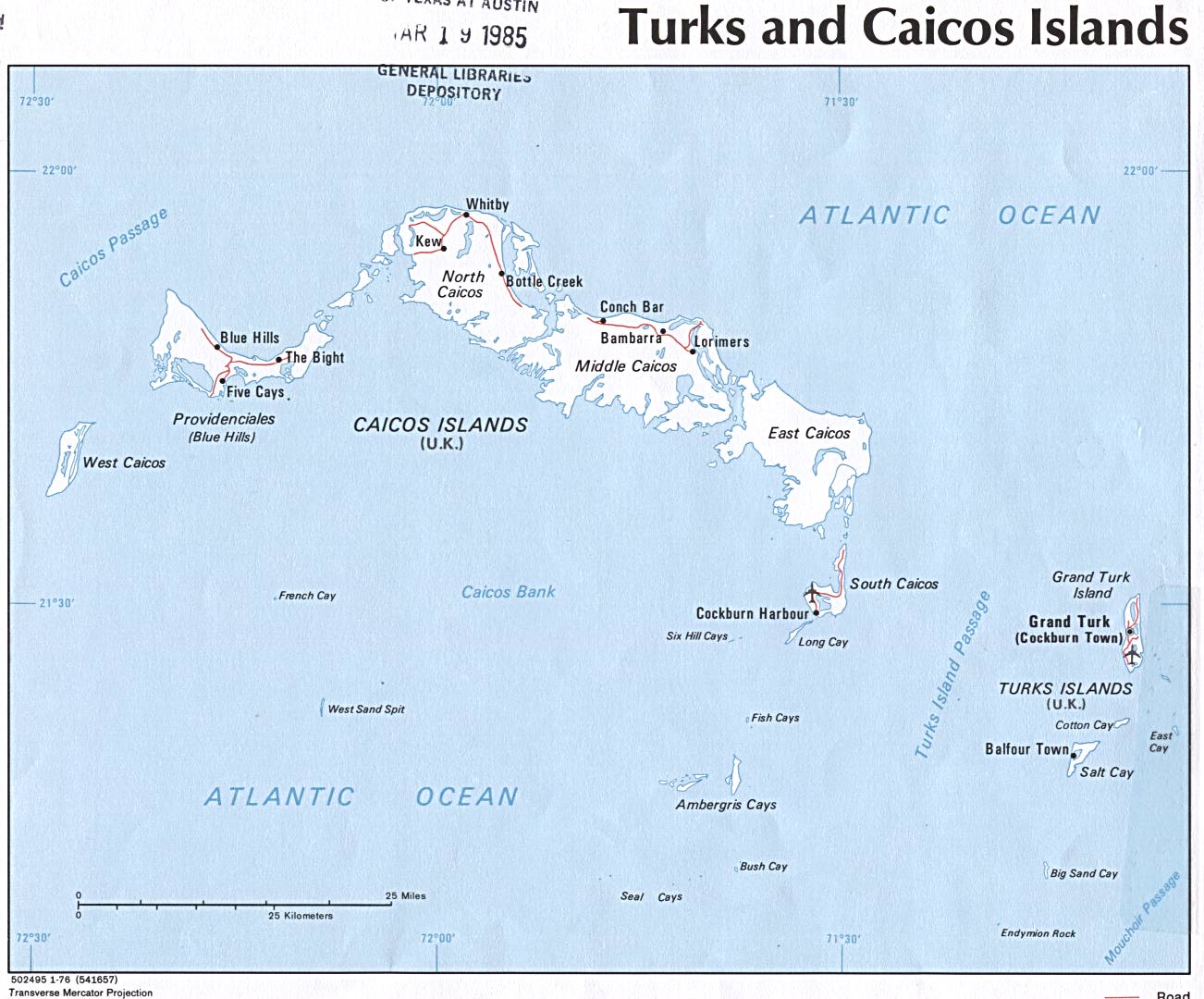
- Turks and Caicos Islands - 1976 political
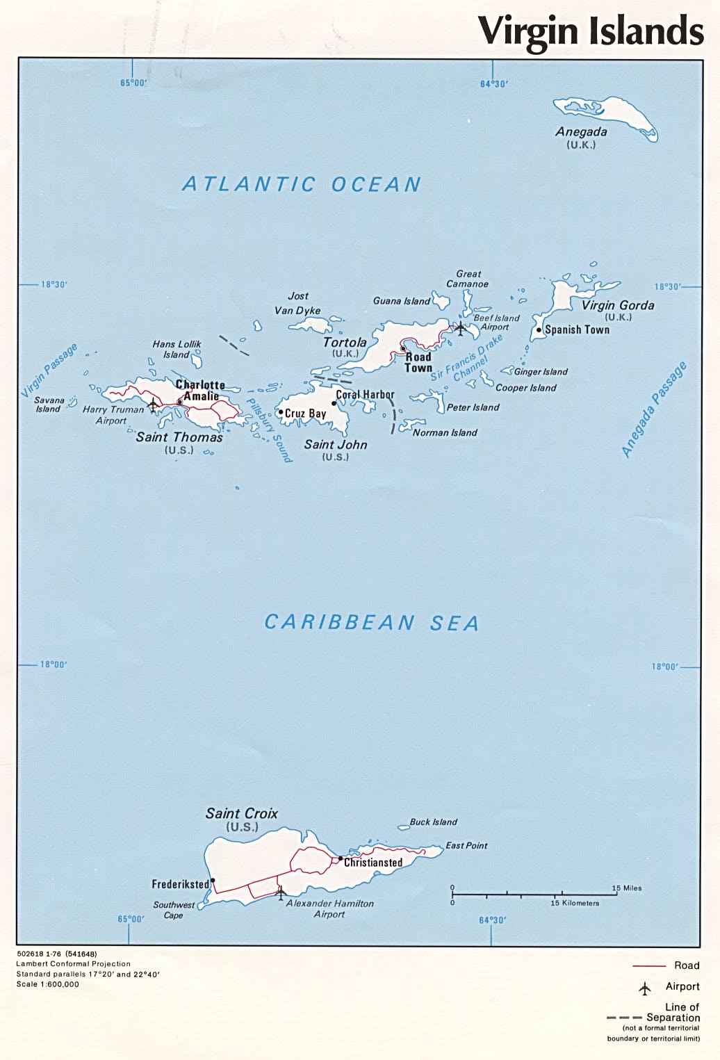
- Virgin Islands - 1976 political
Small maps (web-sized)
Small maps are all made by CIA in 2005. Unlike other maps on this page they are stored locally at Domnik.net.
- Anguilla
- Antigua and Barbuda
- Aruba
- Bahamas
- Belize
- British Virgin Islands
- Cayman Islands
- Cuba
- Dominica
- Dominican Republic
- Grenada
- Guadeloupe
- Haiti
- Jamaica
- Martinique
- Montserrat
- Navassa Island
- Netherlands Antilles
- Puerto Rico
- Saint Kitts and Nevis
- Saint Lucia
- Saint Vincent and the Grenadines
- Trinidad and Tobago
- Turks and Caicos Islands
- U.S. Virgin Islands
PDF maps
- Central America and the Caribbean - 1997 political
- Central America and the Caribbean - 2000 reference
- Cayman Islands - 1976 political
- Grenada - 1990 shaded relief
- Saint Lucia - 1991 shaded relief
- Saint Vincent and the Grenadines - 1996 shaded relief
- Trinidad and Tobago - 1976 political
- Turks and Caicos Islands - 1976 political
See also:
Travel Photos | Matkakuvat | Photos de voyage
Privacy policy | Tietosuojakäytäntö | Règles de confidentialité